
Purchases made through links earn us a small commission, at no extra cost to you.
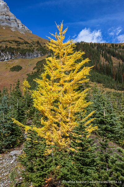
Kananaskis Country is an amazing hiking destination, but it’s especially wonderful in the fall when the larch trees change colour to display vibrant golden needles. This unique phenomenon is why the most popular fall hikes in Kananaskis are ones where you can see larch trees from the trail- a.k.a. “larch hikes”.
.jpg)
Larch Hikes in Kananaskis
The majority of larch trees you’ll see in Kananaskis are Larix lyallii, or subalpine larch. This species of larch lives at high altitudes of 1800 m- 2400 m, so is often found near the treeline.
When you consider where subalpine larch grow and thrive, it’s no surprise that several of the best larch hikes in Kananaskis are located around Highwood Pass, the highest pass in Canada accessible by paved road. Starting your hike from such a high elevation means you don’t have to slog up too many steep hills to reach the larch trees.
.jpg)
While the Highwood Pass area definitely has a big concentration of larch, you can find larch tree hikes in other parts of Kananaskis too, including the area around Smith Dorrien Trail.
To help you plan your fall hikes in Kananaskis, here are some trails where you can see larch trees. Keep in mind this includes a mix of official and unofficial trails (not marked or maintained by Alberta Parks) and is just a selection of all the possible Kananaskis larch hikes. This guide will continue to grow as the Adventure Alberta team ventures out on more larch tree hikes in Kananaskis Country.
.jpg)
If you’re excited to see larch trees in autumn, here are some scenic larch hikes in Kananaskis.
.jpg)
Pocaterra Ridge South via Pocaterra Cirque Trail
Hike Length: 9 km (to the ridge’s south summit and back)
Difficulty: Moderate with a strenuous section up to the ridge
Classification: Unofficial Trail
Trail Guide: South Pocaterra Ridge Hike
The journey along Pocaterra Cirque Trail up to Pocaterra Ridge is one of the best larch hikes in Kananaskis (and most popular) thanks to an abundance of golden larch trees that you can view in close proximity to the trail and from above on the ridge. Along the way there are beautiful views of Highwood Ridge, Mount Tyrwhitt, Mount Pocaterra, and Pocaterra Ridge framing the forest of larch trees.
.jpg)
After passing through an evergreen forest, you’ll arrive in an open valley where you get your first view of larch trees in the distance. The trail proceeds towards Mount Pocaterra and soon you are surrounded by delicate larch. Pocaterra Tarn lies ahead reflecting the beautiful autumn brilliance of the larch trees that line its shore.
.jpg)
Beyond the small lake, the trail begins a gradual ascent along the edge of the larch forest, later arriving at a scenic meadow surrounded by more larch trees. Pocaterra Ridge can be seen looming above the clearing.
.jpg)
After the meadow, the trail starts ascending towards the southern base of the ridge, then makes a long, steep climb up to the south summit. From the top you can enjoy a breathtaking panoramic view of the surrounding Rocky Mountains, Pocaterra Ridge stretching north, and of course the larch trees below.
.jpg)
Ptarmigan Cirque
Hike Length: 3.7 km
Difficulty: Moderate
Classification: Official Trail
Trail Guide: Ptarmigan Cirque Hike
Ptarmigan Cirque is a great option for a short larch hike in Kananaskis. The trail loops around a pretty alpine meadow contained by limestone cliffs and dotted with larch trees. As you hike around the cirque there are wonderful views of larch trees in neighbouring valleys and on the mountains that frame Highwood Pass.
.jpg)
Despite its short length, you do have to embark on a steady climb through the forest to reach the cirque. Eventually the trail splits to make a loop, then rises above the treeline delivering you to a meadow.
.jpg)
At the upper end of the loop the trail crosses some moraine, then makes a gradual descent on the other side of the cirque. Along the way you’ll see larch trees in the meadow and across the highway at Pocaterra Cirque.
.jpg)
Arethusa Cirque
Hike Length: 4.5 km
Difficulty: Moderate
Classification: Unofficial Trail
Trail Guide: Arethusa Cirque Hike
Arethusa Cirque is another beautiful Kananaskis larch hike that can be enjoyed in a half-day trip. The cirque features plenty of larch trees nestled between towering rocky mountains, plus other attractive features like a meadow, stream, gully, rock piles, and snow-dusted peaks.
.jpg)
The hike starts with a gradual ascent through the forest and it’s not long until larch trees come into view. You’ll soon arrive at a small, picturesque meadow bordered by larch and mountains.
.jpg)
At the meadow, the trail splits to form a loop with both tracks eventually ascending up above the treeline. From higher ground, fantastic views of the larch forest below can be admired as you hike around the cirque.
.jpg)
Chester Lake and Elephant Rocks
Hike Length: 9.6 km
Difficulty: Moderate
Classification: Official Trail
Trail Guide: Chester Lake Hike
Chester Lake Trail makes this list of the best larch hikes in Kananaskis because it offers opportunities to see larch trees from open meadows and some deep within the forest, where they’d go unnoticed if it weren’t for their yellow needles. There are also larch trees by the lakeshore and surrounding a pile of big boulders known as the Elephant Rocks.
.jpg)
The hike gradually gains elevation during a rather long walk in the forest, so it takes some time before larch start to appear, tucked away among the other trees. Eventually the trail crosses several meadows where more larch trees can be seen around the perimeter.
.jpg)
Once you reach Chester Lake, you’ll see a group of larch trees by the shore and a few more on the mountainside at the far end of the lake. A short ways beyond the lake you’ll find the Elephant Rocks in a clearing ringed by larch.
.jpg)
Sarrail Ridge via Rawson Lake
Hike Length: 12.2 km
Difficulty: Moderate to the lake then strenuous up to the ridge
Classification: Official Trail to Rawson Lake, unofficial trail to Sarrail Ridge
Trail Guide: Sarrail Ridge Hike
Sarrail Ridge and Rawson Lake isn’t your typical Kananaskis larch hike, since there’s not as many larch trees as other trails on this list, but it is a spectacular setting where you can admire groups of larch from a distance. It’s best to think of this one as a hike where you can see some larch, rather than an immersive “larch hike” since the larch trees are secondary to the surrounding scenery.
.jpg)
The first part of the hike to Rawson Lake is a long walk in the forest with a lengthy uphill (but not steep) section. Greeting you at the lake is a gorgeous view of Sarrail Mountain dominating the western shore. On a calm morning the reflections are dazzling.
.jpg)
As you make your way to the far end of the lake then toward the base of the ridge, you’ll pass by a few solo larch trees, but look up and you’ll see a group growing higher on Sarrail Mountain.
.jpg)
During the very steep, slippery approach to Sarrail Ridge, you’ll pass by a few more small larch trees scattered on the hillside. At the top there are some larch trees on the ridge, but mostly you get to enjoy looking down on them from above, as they grow on the side of the ridge that overlooks Upper Kananaskis Lake. Larch can also be seen growing on the mountain beside Rawson Lake.
.jpg)
More Kananaskis Larch Hikes
You’ll have a good chance of seeing larch trees in Kananaskis Country if you choose a trail on the western side that goes up to the treeline (1800 m and above).
Some other larch tree hikes in Kananaskis you may want to check out are:
- Burstall Pass
- Rummel Lake and Rummel Pass
- Buller Pass
- Tryst Lake
- Piggy Plus Col
- Tent Ridge (the basin around it)
.jpg)
Review of the Larch Hikes in Kananaskis
So many of Kananaskis’ best hikes become extra special in the fall when the larch trees are in their full autumn glory.
.jpg)
With only a few weeks to enjoy the yellow needles before they fall to the ground (more on that below), this means that the best known larch hikes in Kananaskis are very busy, especially on weekends during the last half of September. If you don’t mind sharing the trail with others who have come to appreciate the delicate and fleeting beauty of the larch trees, then hiking in Kananaskis during larch season is a wonderful experience.
.jpg)
Tips for Doing Larch Tree Hikes in Kananaskis
Best Time to See Larch Trees in Kananaskis: Mid to late September is typically larch season, the time when larch tree needles change from green to yellow then gold before falling off the tree in preparation for winter. This means there’s only a 2- 3 week window to see the larch colours.
- If you plan your hiking trip closer to September 15, you’ll likely see the needles just starting to turn. If you hike at the very end of September, the needles could already be falling to the ground. By October 5 the trees will have dropped their needles.
Locations: The larch hikes are found in the western part of Kananaskis Country and can be accessed via Highway 40 (Kananaskis Trail) and the gravelled Highway 742 (Smith Dorrien Trail).
Kananaskis Conservation Pass: To park in Kananaskis Country you need to purchase a daily or annual Kananaskis Conservation Pass. It can easily be bought online and is registered to your licence plate (there’s no physical pass to be displayed in your vehicle). You can also purchase a pass at the Kananaskis Visitor Information Centre on Highway 40 (in person or by using the WiFi).
Visitor Guidelines and Safety: Kananaskis is in bear country. Bring bear spray, make noise while hiking, and educate yourself on what to do if you encounter one. Pay attention to bear warnings and respect trail closures. Bears are known to frequent even the most popular hiking spots, including those around Highwood Pass.
- Avoid going off trail and only hike when the ground is dry. This helps protect the fragile alpine environment and prevents trail braiding.
- If you use a hiking app, download your trail maps ahead of time in case there’s no cell service where you hike.
- The unofficial trails aren’t signed, so research your route in advance. Some routes have been marked with flagging tape by other hikers.
- Weather can change quickly in the mountains so come prepared with layers. Kananaskis can even get snow in September.
- Leave no trace by packing out your garbage. If there are no bins at the trailhead, or they are full, take your garbage home with you.
.jpg)
Accommodations in Canmore and Kananaskis
For your convenience, here is a list of HOTELS IN CANMORE and Kananaskis. Please consider booking your Canmore and Kananaskis accommodations through the included link. It costs nothing extra and helps support this website. Thank you!
Nearby Activities
You may also enjoy these other things to do in Kananaskis:
Shop for Alberta & Adventure Themed Merchandise
.jpg)
.jpg)
.jpg)
Visit our store for more Alberta, nature, and adventure inspired products.


