
Purchases made through links earn us a small commission, at no extra cost to you.
The Chester Lake hike in Kananaskis is a popular trail that delivers hikers to a scenic lake nestled below Mount Chester. On route to Chester Lake, the trail passes through forest and meadows while offering views of mountains, larch trees, and distant glaciers.
.jpg)
The most unique feature you can see on this hike are the Elephant Rocks, two large, isolated piles of stone a short ways beyond Chester Lake.
.jpg)
Chester Lake Hike
Distance: 9.6 km round trip to the Elephant Rocks
Difficulty: Moderate
Elevation Gain: 328 m
Surface: Packed dirt with rock
Trail Type: Out and back
Time: 2.5- 3 hours (not including time at the lake and Elephant Rocks)
Trailhead: Chester Lake Day Use parking lot on Smith Dorrien Trail (Highway 742), about 44 km south of Canmore.
.jpg)
Chester Lake Trail Description
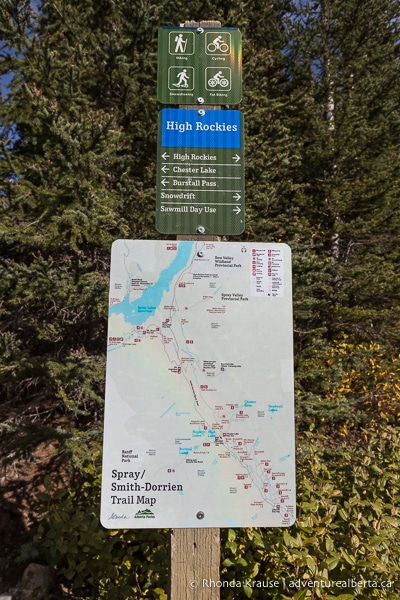
The Chester Lake hike starts from the north end of the large parking lot at the trailhead. You’ll see an information board with a map of the area and a signpost directing you to the proper trail, since there are a few hiking routes accessible from here.
.jpg)
Heading left from the sign, the hike begins by crossing over a wooden bridge then entering into an open forest on a wide dirt trail. Both sides of the path are framed by trees as the trail gradually gains some elevation.
.jpg)
Soon the trail veers right at a signpost and continues through the forest. There’s nothing notable scenery wise just yet, but keep an eye out for grouse in the bushes.
.jpg)
.jpg)
During this lengthy forest walk you’ll be steadily gaining elevation, but the trail is well graded so it’s not steep or challenging for the average hiker. Eventually you’ll come to a marked trail junction where you have the option to continue straight, or go right to take the Chester Lake Trail alternate route.
.jpg)
Keeping straight on the main trail, you’ll still be surrounded by trees and slowly gaining elevation, but soon some mountaintops come into view. This part of the trail is more enjoyable on the return hike when the mountains are directly in front of you, but for now it’s nice to stop and look back at them every so often.
.jpg)
.jpg)
After the trail rounds a bend, it proceeds to wind through the forest, later meeting up with the end of the Chester Lake alternate route. The forest closes in on the trail a bit more and the mountains disappear from view.
.jpg)
It’s not long now until the first larch trees can be seen from the trail. They’re more noticeable in late September, when their needles are golden yellow, especially since they’re tucked away among other trees.
.jpg)
.jpg)
From this point on the scenery on Chester Lake Trail gets more interesting, as it passes through a series of meadows with mountain views.
.jpg)
The first meadow the trail arrives at is small and dotted with larch trees around the perimeter. The path goes right through the middle of the meadow, giving a nice panoramic view of the surrounding forest.
.jpg)
.jpg)
The next meadow on the Chester Lake hike is larger, but because the path keeps close to the trees on one side, the view will be to your right and straight ahead, where Mount Chester can be seen.
.jpg)
After a short walk through another section of forest, the trail arrives at the third, and largest meadow.
.jpg)
.jpg)
.jpg)
The scenery here is glorious, incorporating unobstructed views of Mount Chester, larch trees, a distant glacier, and Chester Creek flowing through the meadow.
.jpg)
.jpg)
.jpg)
Once you reach the other side of the meadow, you’ll pass by an outhouse situated in the trees just off the trail before arriving at the western shore of Chester Lake.
.jpg)
.jpg)
From the shoreline you can see more larch trees and Mount Chester looming above the lake. You may even see some small fish swimming in the clear water.
.jpg)
Some people choose to end their hike at Chester Lake, but it’s worth it to hike a few more minutes to the Elephant Rocks.
.jpg)
To get to the Elephant Rocks, follow the trail north along the western shoreline of Chester Lake. Cross over the little log bridge then keep following the path until you reach an unmarked trail junction. Turn left here onto Three Lakes Valley Trail and head away from the lake.
.jpg)
.jpg)
After a short, easy walk along the tree-framed path, you’ll soon arrive at a meadow dominated by two piles of rock known as the Elephant Rocks.
.jpg)
.jpg)
.jpg)
The Elephant Rocks are a nice place to sit and have lunch because you can enjoy views of Mount Chester while watching chipmunks and squirrels scurrying about.
.jpg)
If you’re hiking Chester Lake in the fall, the Elephant Rocks are a fantastic spot to view colourful larch trees since they surround the meadow, growing in close proximity to the rock piles. There appears to be more larch trees here than at any other spot on Chester Lake Trail.
.jpg)
.jpg)
.jpg)
The Elephant Rocks make a great ending point for your Chester Lake hike, but if you want to explore a little more you could venture further along Three Lakes Valley Trail.
.jpg)
If you’ve decided not to go further than the Elephant Rocks, turn back and follow the same trail you hiked in on, once again passing by Chester Lake then walking through the scenic meadows.
.jpg)
.jpg)
As you descend through the forest, you’ll be better able to appreciate the mountain views that were at your back earlier. The scenery makes for a lovely conclusion to the Chester Lake hike.
.jpg)
.jpg)
Review of the Chester Lake Hike
The Chester Lake hike is an excellent choice if you’re looking for a moderate half-day hike that doesn’t compromise on scenery. Whether you prefer to be surrounded by mountains, walk in the forest, explore meadows, or visit small lakes, you can experience that all (and more) on Chester Lake Trail.
.jpg)
.jpg)
Since Chester Lake Trail has signage and is easy to follow, along with being well-graded to eliminate strenuous climbs, it’s a great hike for new and intermediate hikers. Experienced hikers can find enjoyment too, thanks to the beautiful setting, variety of scenery along the trail, and the option to extend the hike into higher, rockier terrain via Three Lakes Valley Trail.
.jpg)
.jpg)
No matter the season, Chester Lake Trail has something to offer, but it’s especially enjoyable in the fall since it’s one of the easier larch tree hikes in Kananaskis.
.jpg)
Tips for Hiking Chester Lake Trail
Location: Chester Lake Trail is located in Peter Lougheed Provincial Park in Kananaskis Country, next to Smith Dorrien Trail (Highway 742) at the Chester Lake Day Use parking lot. It’s approximately 44 km south of Canmore and 53 km southwest of Kananaskis Village.
Getting to the Chester Lake Trailhead: From Canmore, you can take the gravelled (and very rough in places) Smith Dorrien Trail all the way to the large parking lot at the trailhead.
- Another option is to take Highway 1 east to Highway 40 (Kananaskis Trail), then follow that until you get to Kananaskis Lakes Trail. Take Kananaskis Lakes Trail to the Smith Dorrien then follow that to the trailhead. This way is longer/further but it involves less driving on gravel roads.
Best Time to Hike Chester Lake Trail: Chester Lake Trail is best hiked in summer and during the larch season in September. In winter, there’s a special snowshoe trail that’s different from the route described above.
- Chester Lake Trail is closed from May 1 to June 29 annually to allow the ground to dry and prevent damage.
Kananaskis Conservation Pass: To park in Kananaskis Country you need to purchase a daily or annual Kananaskis Conservation Pass. It can easily be bought online and is registered to your licence plate (there’s no physical pass to be displayed in your vehicle). You can also purchase a pass at the Kananaskis Visitor Information Centre on Highway 40 (in person or by using the WiFi).
Facilities: There are outhouses at the trailhead and one just before the lake.
Visitor Guidelines and Safety: This hike is in bear country so bring bear spray and know how to use it.
- Avoid going off trail to protect the vegetation.
- Leave no trace by packing out your garbage. If bins are full, take your garbage home with you.
- Bicycles are only allowed on the first 2 km of the trail.
Gear and What to Bring: Wear comfortable hiking shoes/boots. Hiking poles aren’t necessary, but are good to use if you have bad knees.
- Dress in layers and bring rain gear because weather can change quickly in the mountains.
.jpg)
Accommodations in Canmore and Kananaskis
For your convenience, here is a list of HOTELS IN CANMORE and KANANASKIS. Please consider booking your Canmore and Kananaskis accommodations through the included link. It costs nothing extra and helps support this website. Thank you!
Nearby Hikes & Activities
You may also enjoy these other trails and things to do in Kananaskis:
Shop for Alberta & Adventure Themed Merchandise
.jpg)
.jpg)
.jpg)
Visit our store for more Alberta, nature, and adventure inspired products.


