
Purchases made through links earn us a small commission, at no extra cost to you.
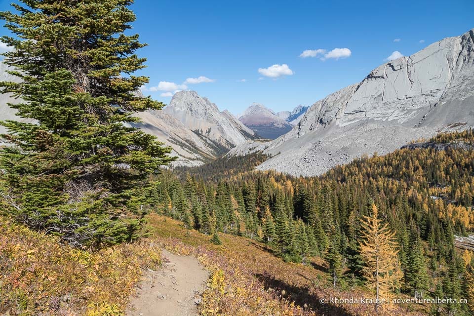
Burstall Pass in Kananaskis is a stunning destination for a hike, especially in autumn when you can gaze down at yellow larch trees in a valley cradled between rocky peaks and bluffs.
.jpg)
Even when not decked out in splendid fall colours, Burstall Pass Trail is an exquisite and worthwhile hike. During the journey, you’ll walk through a forest, cross the willow flats of Burstall Creek, climb to an alpine meadow, and then reach the pass where a panoramic view of mountains awaits.
.jpg)
Bikes are allowed on the first 3.4 km of trail for quicker access to the pass.
.jpg)
Burstall Pass Hike
Distance: 15.2 km round trip (to the pass and back). There’s an opportunity to hike a little further west from the pass to a viewpoint for Leman Lake.
Difficulty: Moderate with some strenuous sections
Elevation Gain: 465 m
Surface: Packed dirt, gravel
Trail Type: Out and back
Time: 5- 6 hours including a break at the pass
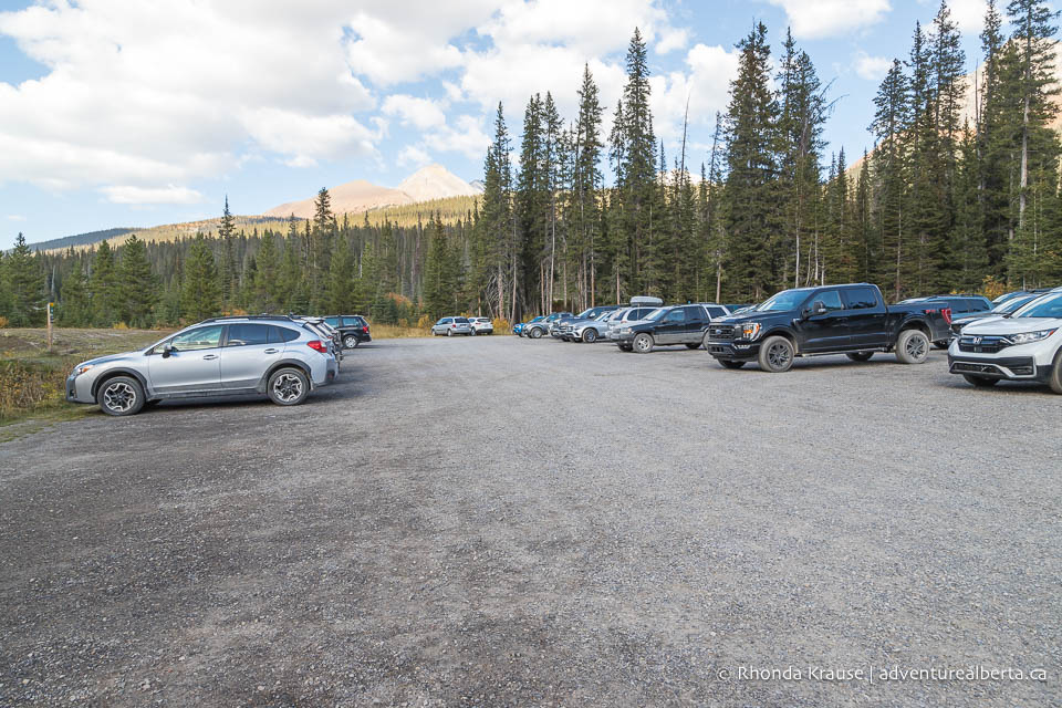
Trailhead: Burstall Pass parking lot on Smith Dorrien Trail (Highway 742), about 44 km south of Canmore.
.jpg)
Burstall Pass Trail Description
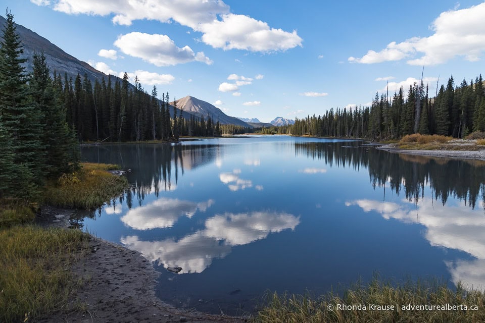
The Burstall Pass hike starts beside Mud Lake, a few steps from the parking lot.
.jpg)
.jpg)
.jpg)
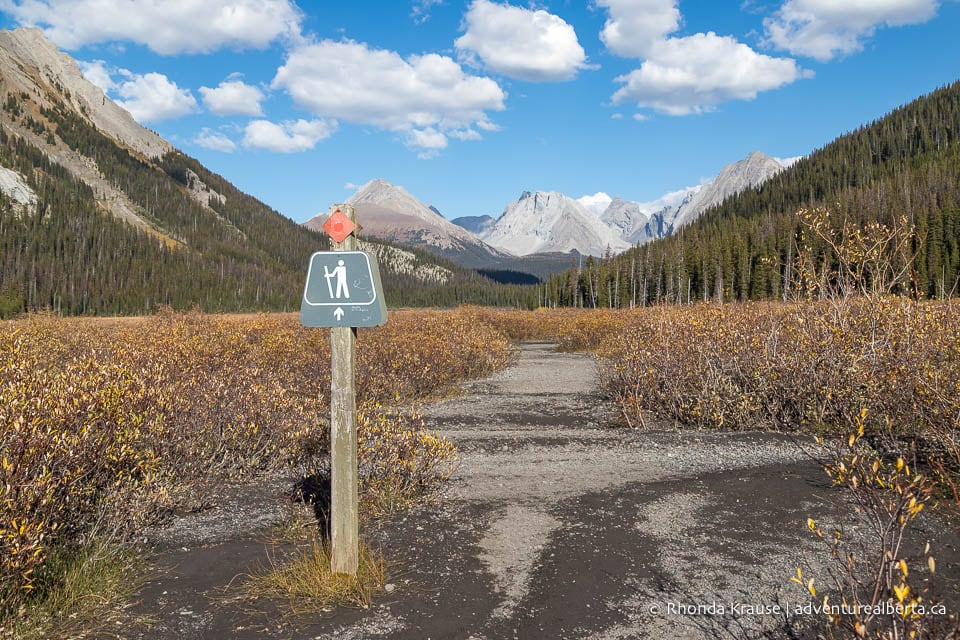
After a short distance following close to the lakeshore, the trail makes a slight curve then splits. Keep right for Burstall Pass Trail (ahead you’ll see a sign with a hiker icon).
.jpg)
.jpg)
The flat, wide path leads towards a mountain and is framed with trees and meadows. Further ahead, the forest becomes more dense. Once again, the trail splits. Keep on the same track as it curves slightly to the right.
.jpg)
.jpg)
.jpg)
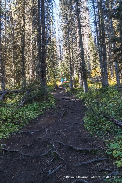
The next segment of this hike isn’t that notable because it’s just a walk in the forest, but there are some nice views of mountain tops.
.jpg)
.jpg)
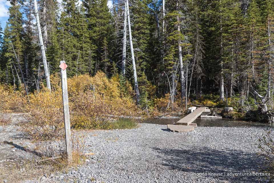
At about the 3.4 km mark, there’s a bike parking area since this is as far as bikes are allowed to go. The wide trail now becomes a single track.
.jpg)
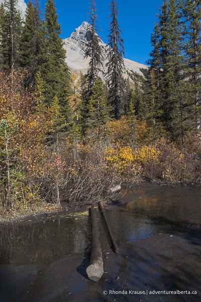
Continuing through the forest you’ll soon come to a boardwalk. A little further ahead and you’ll exit the forest at the willow flats. Here there’s a great view of the mountains, including Commonwealth Peak.
.jpg)
.jpg)
Make your way slightly southwest across the flats towards the long rocky ridge. Up ahead there is a sign with a red diamond and a hiker icon indicating the way, but it can be hard to spot among the shrubs from a distance.
.jpg)
.jpg)
.jpg)
Early in the summer the flats can be quite wet, but later in the season it’s easy to navigate around the braided channels of the creek.
.jpg)
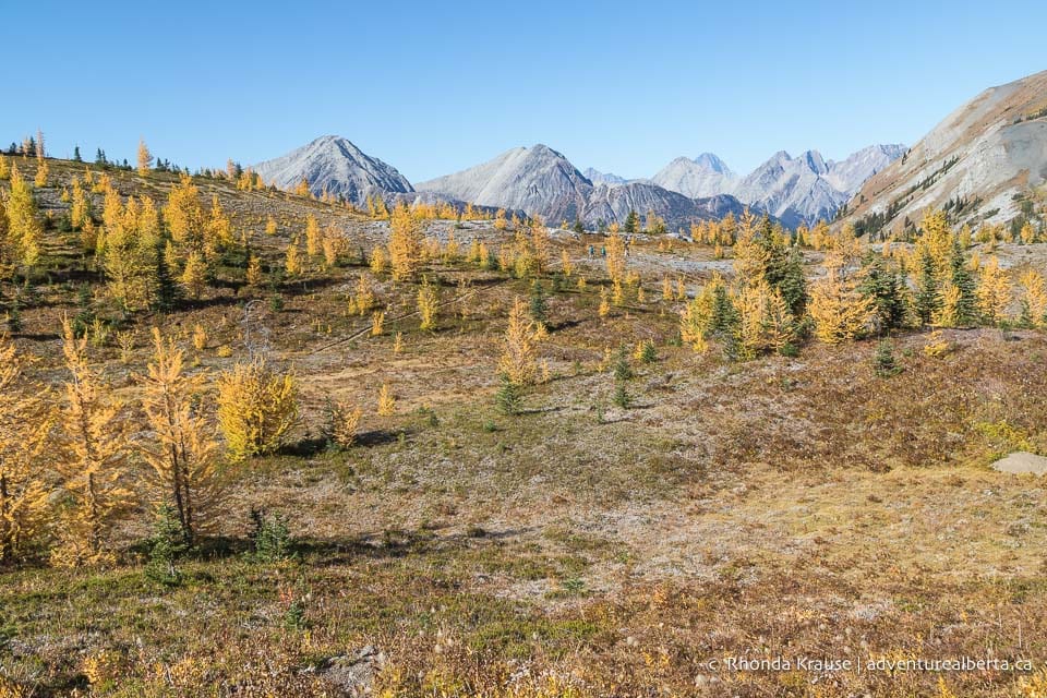
Walking across the flats is one of the most enjoyable parts of this hike (as long as it’s not too wet) because you’re surrounded by scenic mountains. If it’s mid-late September, you’ll be able to see patches of yellow larch trees on the sides of some of the mountains. This is just a preview of what’s to come on Burstall Pass Trail during larch season.
.jpg)
.jpg)
After crossing the willow flats, the trail enters into another section of forest then starts gaining elevation.
.jpg)
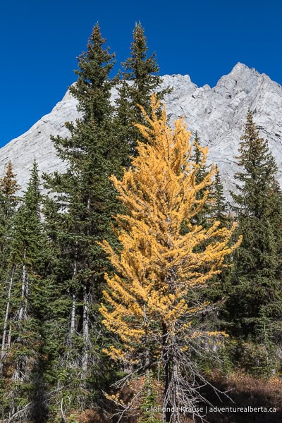
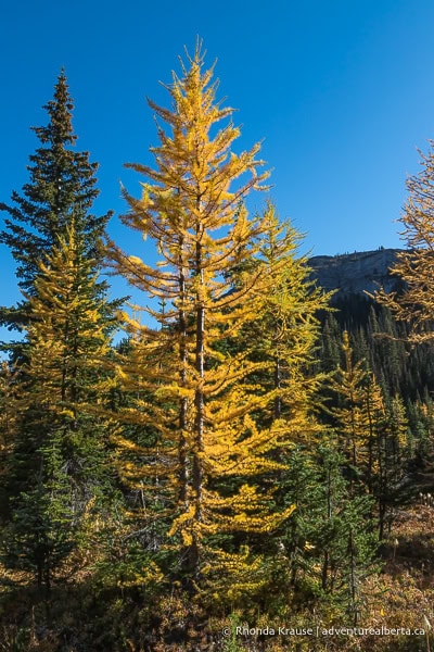
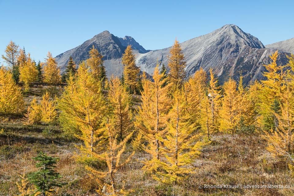
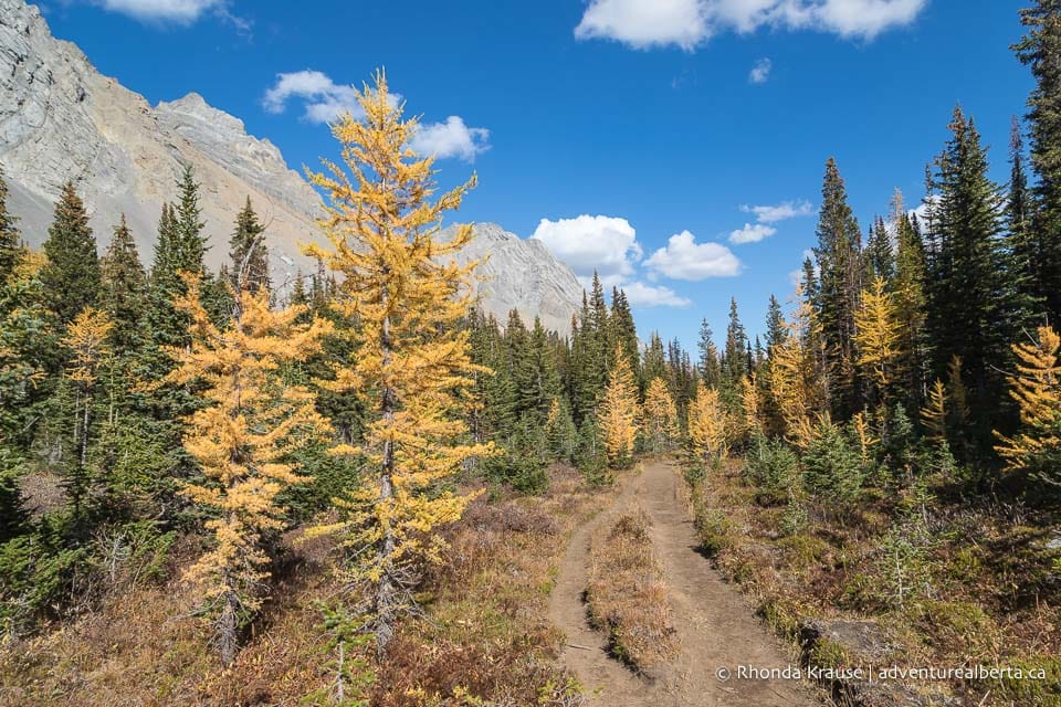
Roughly 1 kilometre later the trail levels out and the forest begins to open up. Here there are some larch trees alongside the path.
.jpg)
.jpg)
A bit further ahead the forest opens up even more into a pretty meadow with mountain views and more larch trees.
.jpg)
.jpg)
.jpg)
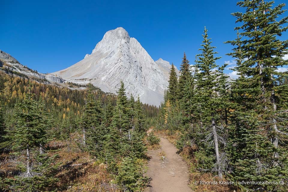
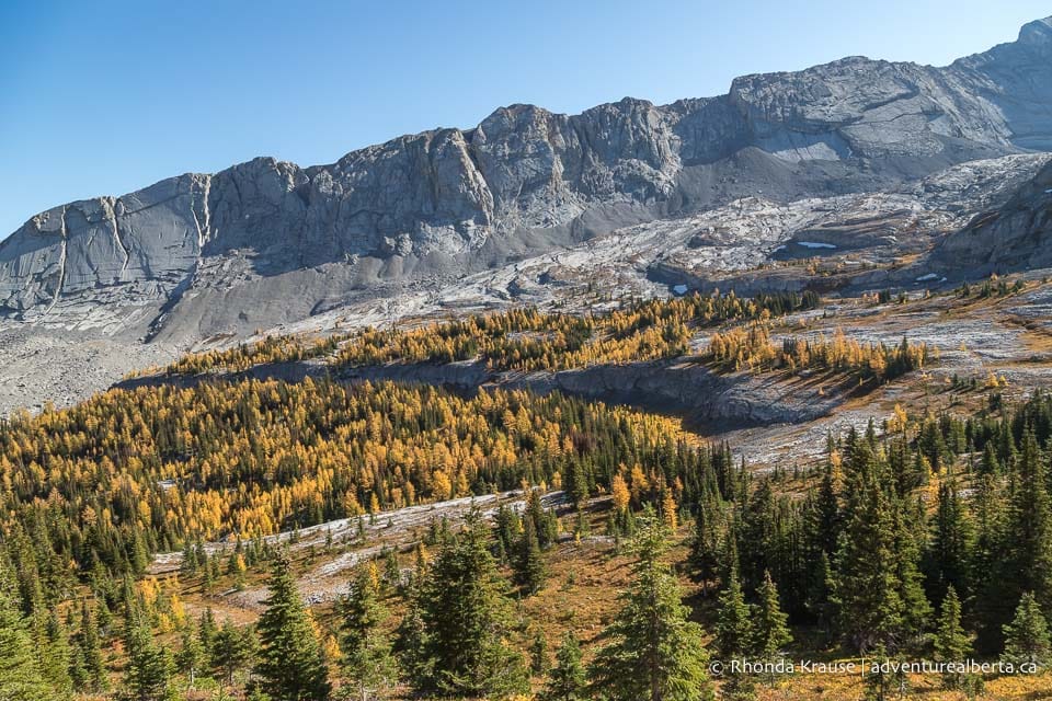
One of the highlights of passing through this meadow is seeing Mount Birdwood and its pyramid-shaped peak towering above. In the autumn, the larch trees are another focal point since you can see them beside the trail and on the nearby mountainside.
.jpg)
.jpg)
.jpg)
At the end of the meadow, the trail again enters a patch of forest then climbs steeply towards Burstall Pass. No worries if you need to stop often to catch your breath- there are plenty of gorgeous views to look at while you do!
.jpg)
.jpg)
.jpg)
As the trail continues to climb you’ll get an elevated view of the forested valley below Mount Birdwood and its neighbouring peaks and ridges.
.jpg)
.jpg)
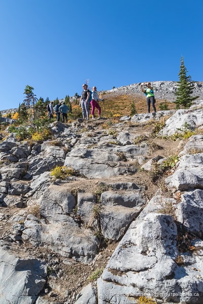
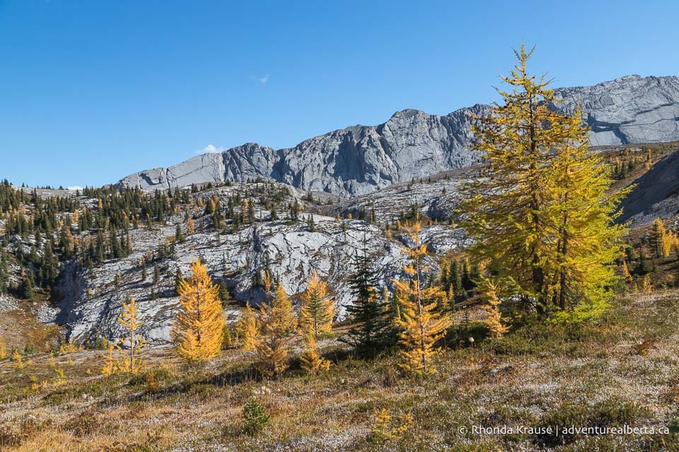
Getting closer to the summit, there’s a short rocky section to ascend but nothing that requires scrambling. Make sure you look behind you after reaching the top of this natural “staircase” because there’s a nice perspective of the valley.
.jpg)
Still climbing up to the pass, the trees become sparse as the landscape transitions from forest to alpine meadow.
.jpg)
.jpg)
.jpg)
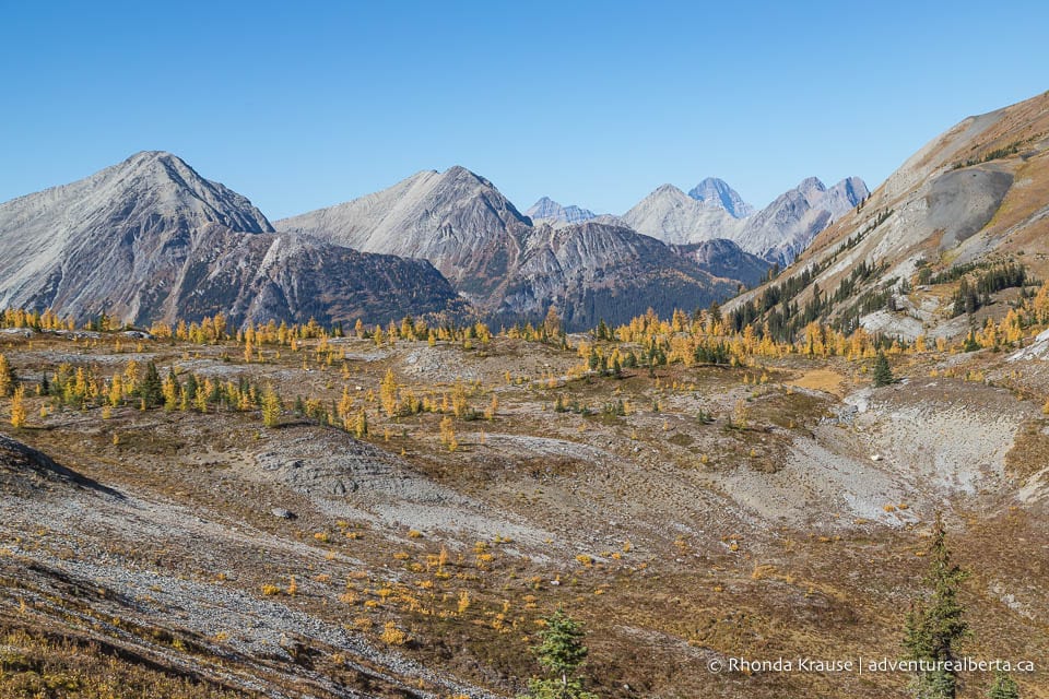
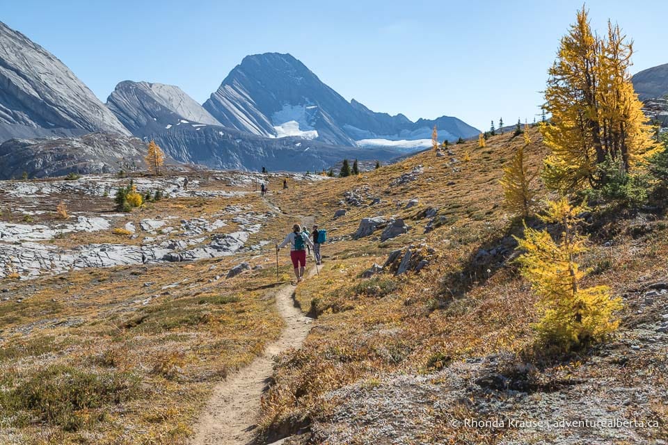
The trail then turns north and soon arrives at the summit ridge, the main destination of this hike. From Burstall Pass there’s a gorgeous view of Mount Birdwood, the valley of larch trees, and distant peaks.
.jpg)
.jpg)
.jpg)
After taking some time to relax at the pass, if you want to hike a little further to another viewpoint and more larch trees, walk down from the summit and follow the obvious trail that heads northwest.
.jpg)
.jpg)
.jpg)
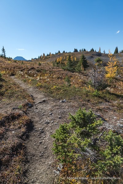
This trail will lead you towards Snow Peak and into Banff National Park. The terrain is rockier and the trail is less sheltered than earlier sections of this hike so there are wide open views to enjoy.
.jpg)
.jpg)
Closer to Snow Peak you’ll pass a sinkhole then the path curves left to head west. There are small patches of larch trees on the rocky rolling land, and on a clear day you can see the peak of Mount Assiniboine in the distance.
.jpg)
.jpg)
.jpg)
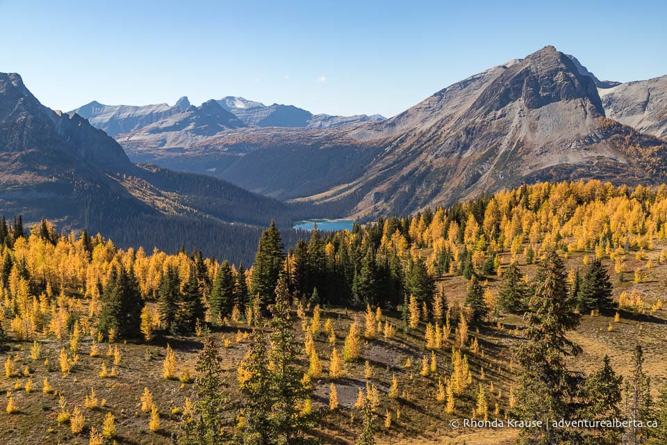
Keep on the narrow, dirt trail until it splits into two. If you want to go to the lookout point (recommended), keep left and walk up the hill. At the end of the path, there’s a great view of Leman Lake and the Spray Valley.
.jpg)
.jpg)
.jpg)
Once you return to the fork in the main trail, if you go left the path will lead you through some larch groves and down to Spray River in the valley. Most people don’t venture further than the Leman Lake viewpoint when doing the Burstall Pass hike as a day trip.
.jpg)
.jpg)
.jpg)
Since this is an out and back hike, to return to the trailhead you’ll take the same route as before. The scenery is just as impressive on the way out as on the way in!
.jpg)
.jpg)
Review of the Burstall Pass Hike
There are so many wonderful things about Burstall Pass Trail, but its top feature is the expansive views from the summit. The vista of peaks is remarkable- the perfect reward after an uphill hike.
.jpg)
The Burstall Pass hike would be lovely in summer, but it really shines in autumn when the larch tree needles are golden yellow. It’s without a doubt one of the best larch hikes in Kananaskis.
.jpg)
.jpg)
Another nice thing about this hike is that it has alternating easy and strenuous sections. The strenuous parts have some of the best views so you can naturally slow down to take it all in.
.jpg)
.jpg)
One of the downsides of this hike is that the long forest walk at the beginning can be a little dull, which is why it’s nice that you could ride a bike to breeze through some of that if you want to.
.jpg)
Overall, Burstall Pass Trail is a well-balanced hike with a variety of scenery and just the right amount of challenge.
.jpg)
.jpg)
More Pictures of Burstall Pass Trail
Here are a few more photos of the Burstall Pass hike.
.jpg)
.jpg)
.jpg)
.jpg)
.jpg)
.jpg)
.jpg)
.jpg)
.jpg)
.jpg)
.jpg)
.jpg)
.jpg)
.jpg)
.jpg)
.jpg)
.jpg)
.jpg)
.jpg)
.jpg)
.jpg)
.jpg)
Tips for Hiking Burstall Pass Trail
Location: Burstall Pass Trail is located in Peter Lougheed Provincial Park in Kananaskis Country, next to Smith Dorrien Trail (Highway 742) at the Burstall Pass parking lot. It’s approximately 44 km south of Canmore and 53 km southwest of Kananaskis Village.
Getting to the Burstall Pass Trailhead: From Canmore, you can take the gravelled (and very rough in places) Smith Dorrien Trail all the way to the large parking lot at the trailhead.
- Another option is to take Highway 1 east to Highway 40 (Kananaskis Trail), then follow that until you get to Kananaskis Lakes Trail. Take Kananaskis Lakes Trail to the Smith Dorrien then follow that to the trailhead. This way is longer/further but it involves less driving on gravel roads.
Best Time to Hike Burstall Pass Trail: Burstall Pass Trail is best hiked from July to October. There can still be snow in June. The larch trees are typically yellow from mid-September to early October.
Kananaskis Conservation Pass: To park in Kananaskis Country you need to purchase a daily or annual Kananaskis Conservation Pass. It can easily be bought online and is registered to your licence plate (there’s no physical pass to be displayed in your vehicle). You can also purchase a pass at the Kananaskis Visitor Information Centre on Highway 40 (in person or by using the WiFi).
Facilities: There is an outhouse at the parking lot.
Visitor Guidelines and Safety: This hike is in bear country so bring bear spray and know how to use it.
- Leave no trace by packing out your garbage. If bins are full, take your garbage home with you.
- Bicycles are only allowed on the first 3.4 km of the trail.
Gear and What to Bring: If hiking between June and July, waterproof shoes or sandals may be needed for creek-crossings at the willow flats.
- Wear comfortable hiking shoes/boots. Hiking poles are nice to have.
- Dress in layers and bring rain gear because the weather can change quickly in the mountains.
Accommodations in Canmore and Kananaskis
For your convenience, here is a list of HOTELS IN CANMORE and KANANASKIS. Please consider booking your Canmore and Kananaskis accommodations through the included link. It costs nothing extra and helps support this website. Thank you!
Nearby Hikes & Activities
You may also enjoy these other trails and things to do in Kananaskis:


